USA Hiking Database
Ausgangspunkte Trailheads
Ausgangspunkte aller USA Wanderungen
Über diese interaktive Landkarte erreichst Du unsere USA-Wanderungen direkt. So ist es recht einfach, Wanderungen entlang Deiner Reiseroute zu finden. Wähle den Ausgangspunkt und klicke Dich zur Detailbeschreibung, den GPS-Daten [gpx Download] und zu den topographischen Wanderkarten.
Trailheads of all USA Hiking Trails
This interactive map will take you directly to our USA hikes. So it is quite easy to find hikes along your itinerary. Select the starting point and click to the detailed description, GPS data [gpx download] and topographic hiking maps.
Interaktive USA Landkarte mit Darstellung aller USA Wanderungen:
Interactive USA map showing all U.S. hikes:

Um die Seite über die Landkarte vernünftig scrollen oder wischen zu können, ohne dass sich der Zoom aktiviert oder sich die Karte verschiebt, ist die Karte gesperrt. Wenn der Mauszeiger auf der Landkarte liegt, entsperrt sich die Karte automatisch nach einer Sekunde. Ein Klick oder Touch auf "Karte entsperren | Unlock map" entsperrt die Karte sofort.

Solange mit der Karte gearbeitet wird, bleibt sie offen. Wenn sich der Mauszeiger außerhalb der Landkarte befindet, sperrt sich die Karte nach 5 Sekunden. Bei Touch Screens kann die Karte über den Button "Karte sperren | Lock map" erneut gesperrt werden.

To be able to scroll or swipe the page over the map reasonably without the zoom activating or the map shifting, the map is locked. When the mouse pointer is on the map, the map unlocks automatically after one second. A click or touch on "Unlock map" unlocks the map immediately.

As long as the map is being worked with, it remains open. If the mouse pointer is outside the map, the map locks after 5 seconds. With touch screens, the map can be locked again using the "Karte sperren | Lock map" button.
Zum Zielgebiet ...
To target area ...

Selection map

Gelände | Topo
Satellit | Satelite

+ = hinein (in)
- = heraus (out)
Default setting
Zum Start der Wanderung ...
To the trailhead ...
Marker an | Cluster aus
leicht
easy
mittel
moderate
schwer
strenuous
Cluster on | Marker off
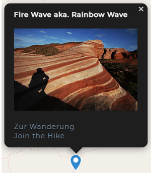
Zur Wanderung ...
To the hike ...

Zur Wanderung
Join the Hike
kommst Du zur Detailbeschreibung.

Zur Wanderung
Join the Hike
you will get to the detailed description.
Zum Ziel ...
To the destination
In der Detailbeschreibung findest Du alle Hikedaten inklusive der Möglichkeit, die GPS-Daten auf Deinen PC und Dein GPS zu laden (Download *.gpx).
Wir beschreiben für Dich die Lage der USA Wanderung, die Anfahrt und den Verlauf des Hikes. Zudem stellen wir Dir eine interaktive und eine topographische Wanderkarte mit freundlicher Genehmigung der Firma National Geographic, USA zur Verfügung. Ergänzend zeigen wir Dir Kommentare, Einschätzungen und aktuelle Meldungen anderer Hiker sowie eine Bewertung, ein Rating der Wanderung.
Die wichtigsten Daten kannst Du auch ausdrucken und als analogen Reiseplan zum Wandern in die USA mitnehmen.

In the detailed description you will find all hike data including the possibility to download the GPS data to your PC and GPS (download *.gpx).
WWe describe for you the location of the USA hike, how to get there and the course of the hike. In addition, we provide you with an interactive and a topographic map of the hike with the kind permission of the company National Geographic, USA. In addition, we show you comments, evaluations and current messages of other hikers as well as an evaluation, a rating of the hike.
You can also print out the most important data and take it with you as an analog travel plan for hiking in the USA.
